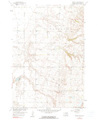
1958 Map of Britton 4 NW
USGS Topo · Published 1990About this map
Hickman, Waverly, and Lowell townships define the landscape of this Marshall County survey, mapped as part of a Department of the Interior program for the development of the Missouri River Basin. The terrain is marked by a significant shift in elevation, where the prairie flats of the west meet the rising slopes of the Sisseton hills. This topographical divide influenced the placement of rural infrastructure, including a Gravel Pit positioned near the transition in elevation.
Find a feature on this map
9 named features on this map. Tap any name to fly to it.
Don’t see what you’re looking for? This feature index may not catch every label — zoom into the map to look around manually.
Map Details
Editions of this 1958 Britton 4 NW Map
3 editions found
Other maps of this area

1953 · Britton East
USGS Topo · 1:24,000

1953 · Milbank
USGS Topo · 1:250,000

1954 · Kidder SE
USGS Topo · 1:24,000

1956 · Britton West
USGS Topo · 1:24,000

1958 · Milbank
USGS Topo · 1:250,000

1958 · Spain
USGS Topo · 1:24,000

1958 · Britton 4 NW
USGS Topo · 1:24,000

1958 · Britton 4 SW
USGS Topo · 1:24,000

1958 · Langford
USGS Topo · 1:24,000

1970 · Britton 4 NE
USGS Topo · 1:24,000