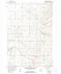
1958 Map of Hickman Lake
USGS Topo · Published 1994About this map
Hickman and Sisseton townships define this rural section of Marshall County during the late 1950s, a period documented by aerial photography for the Missouri River Basin development program. The landscape is characterized by a high density of small water bodies and marshy depressions, typical of the prairie pothole region. Hickman Lake stands as the primary water feature in the southwest, while the surrounding sections are dotted with unnamed sloughs and seasonal basins.
Find a feature on this map
8 named features on this map. Tap any name to fly to it.
Don’t see what you’re looking for? This feature index may not catch every label — zoom into the map to look around manually.
Map Details
Editions of this 1958 Hickman Lake Map
3 editions found
Other maps of this area

1953 · Britton East
USGS Topo · 1:24,000

1953 · Milbank
USGS Topo · 1:250,000

1954 · Kidder SE
USGS Topo · 1:24,000

1956 · Britton West
USGS Topo · 1:24,000

1958 · Milbank
USGS Topo · 1:250,000

1958 · Spain
USGS Topo · 1:24,000

1958 · Britton 4 NW
USGS Topo · 1:24,000

1958 · Britton 4 SW
USGS Topo · 1:24,000

1958 · Langford
USGS Topo · 1:24,000

1970 · Britton 4 NE
USGS Topo · 1:24,000