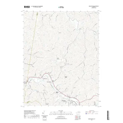
2019 Map of Broad Bottom
USGS Topo · Published 2019About this map
Pikeville and the surrounding river bottomlands are the focal point of this 2019 survey, where the Levisa Fork winds through a landscape defined by narrow valleys and coal-related settlements. The map illustrates the close proximity of several distinct communities, including Broad Bottom, Mossy Bottom, and Coal Run Village, all linked by the corridor of N Mayo Trl. This area exhibits a dense concentration of family history markers, with numerous burial grounds such as Marrs Cem, Blair Cem, and Mullins Cem tucked into the hillsides and hollows like Keyser Hollow and Deskins Hollow. Significant infrastructure is also present, from the Pike County Airport-Hatcher Field on the plateau to the several river crossings including the Mossy Bottom Bridge and Cold Run Bridge. The geography reveals how development is strictly confined to the level ground of the creek bottoms and river bends, surrounded by a complex network of ridges and drainage forks like Caney Fork and Wolf Fork.
Find a feature on this map
133 named features on this map. Tap any name to fly to it.
Don’t see what you’re looking for? This feature index may not catch every label — zoom into the map to look around manually.
Map Details
Editions of this 2019 Broad Bottom Map
This is the sole edition of this map. No revisions or reprints were ever made.
Other maps of this area

1886 · Prestonsburg
USGS Topo · 1:125,000

1886 · Grundy
USGS Topo · 1:125,000

1887 · Warfield
USGS Topo · 1:125,000

1890 · Whitesburg
USGS Topo · 1:125,000

1890 · Grundy
USGS Topo · 1:125,000

1891 · Warfield
USGS Topo · 1:125,000

1892 · Grundy
USGS Topo · 1:125,000

1892 · Whitesburg
USGS Topo · 1:125,000

1892 · Prestonsburg
USGS Topo · 1:125,000

1914 · Laynesville
USGS Topo · 1:48,000