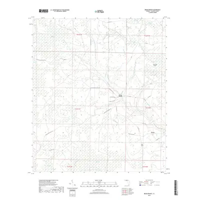
2018 Map of Broad Branch
USGS Topo · Published 2018About this map
Broad Branch and Kinard serve as the primary human touchpoints in this low-lying region of Calhoun County, Florida. The landscape is defined by an intricate network of wetlands and drainage systems, including Buzzard Bay Swamp, Clewis Swamp, and Old Camp Four Swamp. The hydrography here is exceptionally dense, with numerous tributaries such as Cypress Cr, Little Cypress Cr, and Straw Bay Br feeding into larger systems like Broad Br. The presence of features like Mill Point and Watering Pond suggests localized historical land use within a predominantly swampy environment. A grid of named rural routes, including Youngstown Scotts Ferry Rd, Chester Pickron Rd, and several legacy Civilian Conservation Corps roads like CCC Road No 16, provides access through the wet terrain of Straw Bay Islands and the expansive Wetappo Swamp.
Find a feature on this map
45 named features on this map. Tap any name to fly to it.
Don’t see what you’re looking for? This feature index may not catch every label — zoom into the map to look around manually.
Map Details
Editions of this 2018 Broad Branch Map
This is the sole edition of this map. No revisions or reprints were ever made.
Other maps of this area

1944 · Clarksville
USGS Topo · 1:31,680

1945 · Dead Lake
USGS Topo · 1:31,680

1945 · Juniper Creek
USGS Topo · 1:31,680

1945 · Youngstown
USGS Topo · 1:31,680

1945 · Clarksville
USGS Topo · 1:31,680

1945 · Broad Branch
USGS Topo · 1:31,680

1945 · North Of Allanton
USGS Topo · 1:31,680

1945 · Frink
USGS Topo · 1:31,680

1945 · Fountain
USGS Topo · 1:31,680

1945 · Tenmile Swamp
USGS Topo · 1:31,680