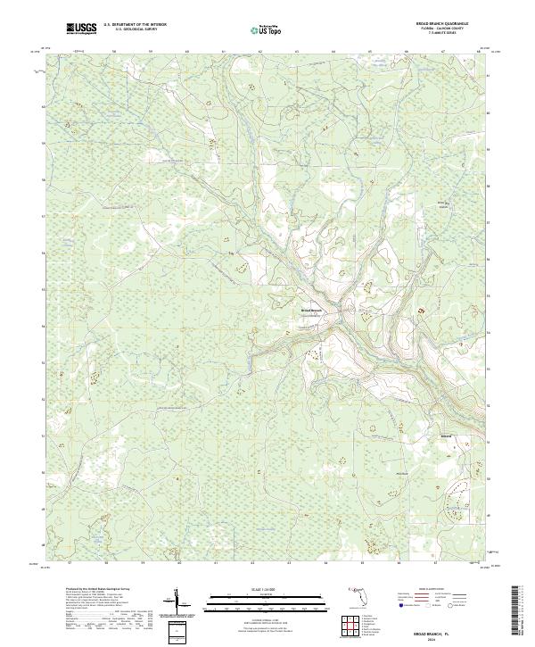
2024 Map of Broad Branch
USGS Topo · Published 2024About this map
Cypress Creek winds through a dense network of lowland drainages and wetlands in this portion of Calhoun County. The settlement of Broad Branch serves as a central point for the local road network, where Charlie Skipper Rd and Johnnie Skipper Rd reflect the long-standing family ties to the land. The landscape is defined by its extensive swamp systems, including Buzzard Bay Swamp, Old Camp Four Swamp, and the interestingly named Thirty-One Swamp.
Find a feature on this map
47 named features on this map. Tap any name to fly to it.
Don’t see what you’re looking for? This feature index may not catch every label — zoom into the map to look around manually.
Map Details
Editions of this 2024 Broad Branch Map
This is the sole edition of this map. No revisions or reprints were ever made.
Other maps of this area

1944 · Clarksville
USGS Topo · 1:31,680

1945 · Dead Lake
USGS Topo · 1:31,680

1945 · Juniper Creek
USGS Topo · 1:31,680

1945 · Youngstown
USGS Topo · 1:31,680

1945 · Clarksville
USGS Topo · 1:31,680

1945 · Broad Branch
USGS Topo · 1:31,680

1945 · North Of Allanton
USGS Topo · 1:31,680

1945 · Frink
USGS Topo · 1:31,680

1945 · Fountain
USGS Topo · 1:31,680

1945 · Tenmile Swamp
USGS Topo · 1:31,680