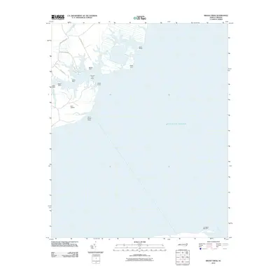
2010 Map of Broad Creek
USGS Topo · Published 2010About this map
Swan Island and the intricate marshlands surrounding Swan Creek dominate the northern reaches of this coastal landscape. The terrain is defined by a series of named points reaching into the water, including Dowdy Point, Tonney Hill Point, and Grace Point, which suggest a long history of local navigation and land division. To the south, the environment shifts toward the open expanse of the Atlantic Ocean, marked by the hazardous Gum Thicket Shoal and the slender Turnagain Bay Spit. Residential development appears concentrated along the northwestern edge, where roads like Whortonsville Rd and Paradise Shores Rd provide access to the waterfront. This 2010 survey illustrates a delicate coastal balance, where small creeks such as Parris Creek and Mill Creek weave through tidal flats before meeting the larger bay.
Find a feature on this map
27 named features on this map. Tap any name to fly to it.
Don’t see what you’re looking for? This feature index may not catch every label — zoom into the map to look around manually.
Map Details
Editions of this 2010 Broad Creek Map
This is the sole edition of this map. No revisions or reprints were ever made.
Other maps of this area

1948 · Oriental
USGS Topo · 1:24,000

1949 · Point Of Marsh
USGS Topo · 1:24,000

1949 · Long Bay
USGS Topo · 1:24,000

1949 · Merrimon
USGS Topo · 1:24,000

1949 · South River
USGS Topo · 1:24,000

1950 · Long Bay
USGS Topo · 1:24,000

1950 · South River
USGS Topo · 1:24,000

1950 · Point Of Marsh
USGS Topo · 1:24,000

1950 · Vandemere
USGS Topo · 1:24,000

1950 · Jones Bay
USGS Topo · 1:24,000