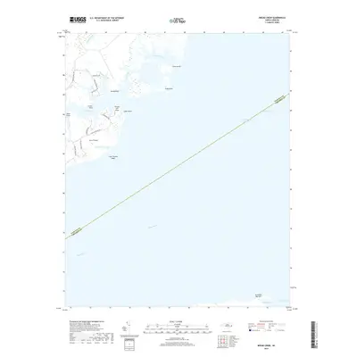
2019 Map of Broad Creek
USGS Topo · Published 2019About this map
The Intracoastal Waterway cuts diagonally across this coastal landscape where the Neuse River meets the Pamlico Sound. The geography is defined by a series of low-lying peninsulas and marshy islands, including Swan Island and Piney Point, which shelter small water bodies like Swan Creek and Green Creek. Settlement is concentrated around Gum Thicket, where local roads such as Old Lighthouse Rd and Harborside Dr provide access to the waterfront at Grace Point and Skate Point. The southern portion of the map is dominated by open water, transitioning toward Abraham Bay and Turnagain Bay, with the hazardous Gum Thicket Shoal marking the shallow reaches of the sound. This survey documents the modern coastal boundary between Pamlico and Carteret counties, illustrating how residential clusters have developed along the intricate fingers of Broad Creek.
Find a feature on this map
32 named features on this map. Tap any name to fly to it.
Don’t see what you’re looking for? This feature index may not catch every label — zoom into the map to look around manually.
Map Details
Editions of this 2019 Broad Creek Map
This is the sole edition of this map. No revisions or reprints were ever made.
Other maps of this area

1948 · Oriental
USGS Topo · 1:24,000

1949 · Point Of Marsh
USGS Topo · 1:24,000

1949 · Long Bay
USGS Topo · 1:24,000

1949 · Merrimon
USGS Topo · 1:24,000

1949 · South River
USGS Topo · 1:24,000

1950 · Long Bay
USGS Topo · 1:24,000

1950 · South River
USGS Topo · 1:24,000

1950 · Point Of Marsh
USGS Topo · 1:24,000

1950 · Vandemere
USGS Topo · 1:24,000

1950 · Jones Bay
USGS Topo · 1:24,000