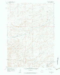
1959 Map of Broad Mesa
USGS Topo · Published 1984About this map
102 Ranch anchors the western side of this high plains landscape in central Wyoming, a region defined by extensive drainage networks and prominent plateaus. Based on aerial photography from 1954 and field checked in 1959, the map illustrates the varied terrain of Broad Mesa and the winding course of Wallace Creek. Water resources in this arid environment are marked by features like Middle Fork Casper Creek and McClanahan Draw, which carved distinct paths through the elevation. A prominent Pipeline cuts across the southern sections, indicating early industrial infrastructure in Natrona County during the mid-century. This survey provides a precise view of the ranching and energy-related footprint as it existed before further modernization altered the local landscape.
Find a feature on this map
7 named features on this map. Tap any name to fly to it.
Don’t see what you’re looking for? This feature index may not catch every label — zoom into the map to look around manually.
Map Details
Editions of this 1959 Broad Mesa Map
3 editions found
Other maps of this area

1952 · Waltman
USGS Topo · 1:24,000

1952 · Hiland
USGS Topo · 1:24,000

1955 · Arminto
USGS Topo · 1:250,000

1955 · Casper
USGS Topo · 1:250,000

1958 · Casper
USGS Topo · 1:250,000

1958 · Arminto
USGS Topo · 1:250,000

1959 · Gaylord Reservoir
USGS Topo · 1:24,000

1959 · Eightmile Draw
USGS Topo · 1:24,000

1959 · Broad Mesa
USGS Topo · 1:24,000
1959 · Mc Rae Gap
USGS Topo · 1:24,000