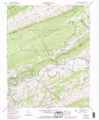
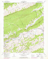
1958 Map of Broadford
USGS Topo · Published 1978About this map
The industrial and agricultural landscapes of Smyth and Tazewell Counties meet along the North Fork Holston River, where the Mathieson Chemical Corp facility near Saltville dominates the valley floor. This 1958 survey, with revisions into the mid-1970s, documents a region defined by steep ridges like Clinch Mountain and the deep incisions of Poor Valley. The Norfolk and Western railroad corridor tracks the river's path, connecting small communities such as North Holston and McReady.
Find a feature on this map
73 named features on this map. Tap any name to fly to it.
Don’t see what you’re looking for? This feature index may not catch every label — zoom into the map to look around manually.
Map Details
Editions of this 1958 Broadford Map
5 editions found
Other maps of this area

1891 · Tazewell
USGS Topo · 1:125,000

1891 · Abingdon
USGS Topo · 1:125,000

1894 · Abingdon
USGS Topo · 1:125,000

1895 · Tazewell
USGS Topo · 1:125,000

1897 · Tazewell
USGS Topo · 1:125,000

1909 · Abingdon
USGS Topo · 1:96,000

1911 · Abingdon
USGS Topo · 1:125,000

1912 · Pounding Mill
USGS Topo · 1:62,500

1915 · Richlands
USGS Topo · 1:48,000

1916 · Pounding Mill
USGS Topo · 1:62,500