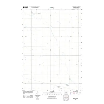
2012 Map of Broadland
USGS Topo · Published 2012About this map
James Valley Junction anchors the southern portion of this Beadle County landscape, marking a vital point of transit and connection in the rural interior of South Dakota. The survey reveals a strict, expansive grid of section-line roads, such as 394th Ave and 203rd St, which define the agricultural character of the region. Small, scattered seasonal wetlands and prairie depressions are interspersed throughout the rectilinear fields, contrasting with the engineered precision of the road network. In the northern reaches, the thoroughfare of Broadland St provides an east-west axis through the terrain. The presence of specialized street names like Stilo St and W Park Ave NW suggests the edges of more structured development near the southern border, where the rural grid begins to meet the outskirts of larger settlements.
Find a feature on this map
21 named features on this map. Tap any name to fly to it.
Don’t see what you’re looking for? This feature index may not catch every label — zoom into the map to look around manually.
Map Details
Editions of this 2012 Broadland Map
This is the sole edition of this map. No revisions or reprints were ever made.
Other maps of this area

1895 · Byron
USGS Topo · 1:125,000

1898 · Huron
USGS Topo · 1:125,000

1953 · Huron
USGS Topo · 1:250,000

1954 · Huron
USGS Topo · 1:250,000

1956 · Lake Byron
USGS Topo · 1:24,000

1956 · Hitchcock SE
USGS Topo · 1:24,000

1957 · Huron
USGS Topo · 1:24,000

1958 · Huron NW
USGS Topo · 1:24,000

1967 · Hitchcock SW
USGS Topo · 1:24,000
1973 · Wolsey
USGS Topo · 1:24,000