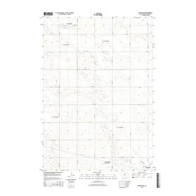
2015 Map of Broadland
USGS Topo · Published 2015About this map
The small community of Broadland anchors the northern reaches of this Beadle County landscape, where the flat prairie is methodically divided by a strict grid of section roads. Moving south toward the northern outskirts of Huron, the geography reveals the rural infrastructure of the mid-2010s, defined by long north-south thoroughfares like 395th Ave and 397th Ave. This area represents the quintessential South Dakota agricultural heartland, where the land is partitioned into township ranges including t112n r63w and t112n r62w. A notable geographic marker is James Valley Junction, situated just north of the city limits near the diagonal path of Appaloosa Trl. The map illustrates how transportation networks, from county routes like Cr-14 to residential streets such as Mustang St, have shaped the development patterns between the isolated grain elevators of the north and the expanding urban edge of the south.
Find a feature on this map
27 named features on this map. Tap any name to fly to it.
Don’t see what you’re looking for? This feature index may not catch every label — zoom into the map to look around manually.
Map Details
Editions of this 2015 Broadland Map
This is the sole edition of this map. No revisions or reprints were ever made.
Other maps of this area

1895 · Byron
USGS Topo · 1:125,000

1898 · Huron
USGS Topo · 1:125,000

1953 · Huron
USGS Topo · 1:250,000

1954 · Huron
USGS Topo · 1:250,000

1956 · Lake Byron
USGS Topo · 1:24,000

1956 · Hitchcock SE
USGS Topo · 1:24,000

1957 · Huron
USGS Topo · 1:24,000

1958 · Huron NW
USGS Topo · 1:24,000

1967 · Hitchcock SW
USGS Topo · 1:24,000
1973 · Wolsey
USGS Topo · 1:24,000