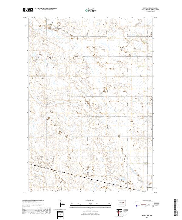
2021 Map of Broadland
USGS Topo · Published 2021About this map
Broadland remains the primary settlement in this section of the South Dakota prairie, situated at the intersection of Broadview St and Broadland St. The landscape is defined by the Public Land Survey System grid, which organizes the territory into townships including t112n r63w and t111n r62w. A dense network of section-line roads such as 393rd Ave and 200th St provides access across the agricultural terrain, while numerous small wetlands and depressions punctuate the fields.
Find a feature on this map
27 named features on this map. Tap any name to fly to it.
Don’t see what you’re looking for? This feature index may not catch every label — zoom into the map to look around manually.
Map Details
Editions of this 2021 Broadland Map
This is the sole edition of this map. No revisions or reprints were ever made.
Other maps of this area

1895 · Byron
USGS Topo · 1:125,000

1898 · Huron
USGS Topo · 1:125,000

1953 · Huron
USGS Topo · 1:250,000

1954 · Huron
USGS Topo · 1:250,000

1956 · Lake Byron
USGS Topo · 1:24,000

1956 · Hitchcock SE
USGS Topo · 1:24,000

1957 · Huron
USGS Topo · 1:24,000

1958 · Huron NW
USGS Topo · 1:24,000

1967 · Hitchcock SW
USGS Topo · 1:24,000
1973 · Wolsey
USGS Topo · 1:24,000