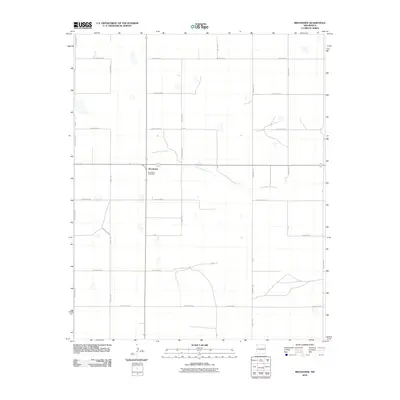
2010 Map of Broadview
USGS Topo · Published 2010About this map
Broadview serves as the central hub of this agricultural landscape in eastern New Mexico, anchored by the Broadview Post Office at the intersection of several key rural routes. The terrain is defined by a systematic grid of county roads, including Curry Road 42 and Curry Road M, which organize the vast plains for ranching and farming. The most significant natural drainage feature is Tierra Blanca Creek, which winds its way across the central and eastern portions of the quadrangle. This 2010 survey reflects the enduring rural character of Curry County, where long-established family names are often preserved in the labeling of the road network, such as Humphrey Rd. The map illustrates a region where local infrastructure is tightly integrated with the natural topography of the High Plains.
Find a feature on this map
33 named features on this map. Tap any name to fly to it.
Don’t see what you’re looking for? This feature index may not catch every label — zoom into the map to look around manually.
Map Details
Editions of this 2010 Broadview Map
This is the sole edition of this map. No revisions or reprints were ever made.
Other maps of this area

1954 · Clovis
USGS Topo · 1:250,000

1957 · Pleasant Hill
USGS Topo · 1:62,500

1957 · Hammond Ranch
USGS Topo · 1:62,500

1958 · Clovis
USGS Topo · 1:250,000

1971 · Day Canyon
USGS Topo · 1:24,000

1971 · Wheatland
USGS Topo · 1:24,000

1971 · Broadview
USGS Topo · 1:24,000

1971 · Grady
USGS Topo · 1:24,000

1971 · Bellview
USGS Topo · 1:24,000
1971 · Endee Hill
USGS Topo · 1:24,000