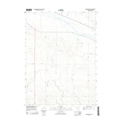
2014 Map of Broadwater SW
USGS Topo · Published 2014About this map
The North Platte River corridors of Morrill County are defined by an intricate network of early twentieth-century irrigation infrastructure, visible here in 2014. These engineered waterways, including the Belmont Canal, Beerline Canal, and Browns Cr Canal, reflect the area's transition from open range to a managed agricultural landscape. While the river dominates the northern section, the southern terrain is marked by natural hydrology such as Deep Holes Spring and Camp Creek Springs. The map reveals how the modern highway system, including Us-385 and Ne-92, follows the established topography of the river valley. This survey serves as a clear record of the persistent relationship between western water rights and the rural road grid that organizes the Nebraska panhandle.
Find a feature on this map
25 named features on this map. Tap any name to fly to it.
Don’t see what you’re looking for? This feature index may not catch every label — zoom into the map to look around manually.
Map Details
Editions of this 2014 Broadwater SW Map
This is the sole edition of this map. No revisions or reprints were ever made.
Other maps of this area

1896 · Browns Creek
USGS Topo · 1:125,000

1898 · Camp Clarke
USGS Topo · 1:125,000

1899 · Browns Creek
USGS Topo · 1:125,000

1899 · Sidney
USGS Topo · 1:125,000

1954 · Scottsbluff
USGS Topo · 1:250,000

1958 · Scottsbluff
USGS Topo · 1:250,000

1965 · Broadwater
USGS Topo · 1:24,000

1965 · Courthouse Rock
USGS Topo · 1:24,000

1965 · Broadwater NW
USGS Topo · 1:24,000
1965 · Bridgeport
USGS Topo · 1:24,000