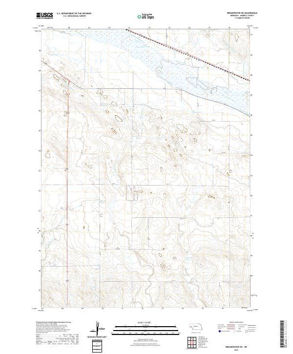
2021 Map of Broadwater SW
USGS Topo · Published 2021About this map
The North Platte River defines the northern reaches of this Morrill County landscape, where an intricate network of irrigation infrastructure supports the region's agricultural vitality. Several vital waterways, including the Beerline Canal, Belmont Canal, and Browns Cr Canal, draw from the river to feed the surrounding plains. The terrain is notably marked by hydrologic features such as Deep Holes Spring and the associated Deep Holes Creek, which provide critical water sources in an otherwise arid environment. Further south, Camp Creek Springs emerges as another significant natural landmark. The map detail reflects the organized rural development of the early 21st century, documented through a precise grid of local roads like RD 123 and RD 78 that partition the large-scale ranching and farming tracts of western Nebraska.
Find a feature on this map
26 named features on this map. Tap any name to fly to it.
Don’t see what you’re looking for? This feature index may not catch every label — zoom into the map to look around manually.
Map Details
Editions of this 2021 Broadwater SW Map
This is the sole edition of this map. No revisions or reprints were ever made.
Other maps of this area

1896 · Browns Creek
USGS Topo · 1:125,000

1898 · Camp Clarke
USGS Topo · 1:125,000

1899 · Browns Creek
USGS Topo · 1:125,000

1899 · Sidney
USGS Topo · 1:125,000

1954 · Scottsbluff
USGS Topo · 1:250,000

1958 · Scottsbluff
USGS Topo · 1:250,000

1965 · Broadwater
USGS Topo · 1:24,000

1965 · Courthouse Rock
USGS Topo · 1:24,000

1965 · Broadwater NW
USGS Topo · 1:24,000
1965 · Bridgeport
USGS Topo · 1:24,000