
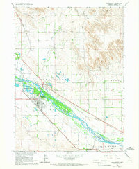
1965 Map of Broadwater SW
USGS Topo · Published 1967About this map
The North Platte River carves a broad valley through the center of this Nebraska landscape, where the legacy of westward expansion meets mid-century irrigation systems. The historic path of the Emigrant Trail is clearly delineated as it parallels the river, providing a geographical reference for the overland migration routes of the 19th century. Below the bluffs, the Union Pacific railroad and the Beerline access follow the water, marking the transition from animal-powered travel to industrial transport.
Find a feature on this map
20 named features on this map. Tap any name to fly to it.
Don’t see what you’re looking for? This feature index may not catch every label — zoom into the map to look around manually.
Map Details
Editions of this 1965 Broadwater SW Map
This is the sole edition of this map. No revisions or reprints were ever made.
Other maps of this area

1896 · Browns Creek
USGS Topo · 1:125,000

1898 · Camp Clarke
USGS Topo · 1:125,000

1899 · Browns Creek
USGS Topo · 1:125,000

1899 · Sidney
USGS Topo · 1:125,000

1954 · Scottsbluff
USGS Topo · 1:250,000

1958 · Scottsbluff
USGS Topo · 1:250,000

1965 · Broadwater
USGS Topo · 1:24,000

1965 · Courthouse Rock
USGS Topo · 1:24,000

1965 · Broadwater NW
USGS Topo · 1:24,000
1965 · Bridgeport
USGS Topo · 1:24,000