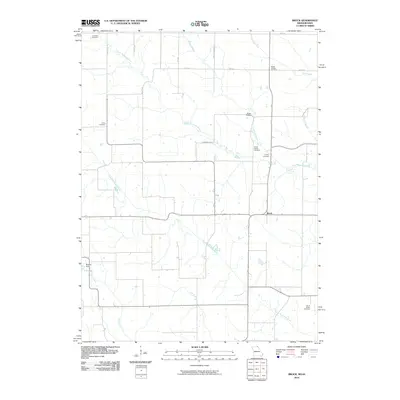
2010 Map of Brock
USGS Topo · Published 2010About this map
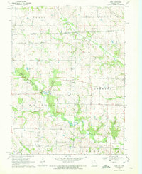
The North Wyaconda River and South Wyaconda River define the rural topography of Scotland County, Missouri, carving through a landscape of agrarian section lines and family-named landmarks. The small settlement of Brock serves as a central point in this northern Missouri region, where the network of gravel and paved roads like Valley Ave and Wheat Ave connect isolated farmsteads and historic burial grounds. The high density of family and community cemeteries, including Hubbard Cemetery, Trinity Cemetery, and the distant South Bethel Cemetery, offers a significant resource for genealogical research, anchoring current property lines to nineteenth-century settlement patterns. Modern water management is visible at Bechtel Dam and the nearby 1 B Lake, while smaller tributaries such as Billups Branch and Cook Creek illustrate the natural drainage system that has influenced local land use for generations.
Find a feature on this map
26 named features on this map. Tap any name to fly to it.
Don’t see what you’re looking for? This feature index may not catch every label — zoom into the map to look around manually.
Map Details
Editions of this 2010 Brock Map
This is the sole edition of this map. No revisions or reprints were ever made.
Other maps of this area

1903 · Edina
USGS Topo · 1:125,000

1954 · Centerville
USGS Topo · 1:250,000

1957 · Centerville
USGS Topo · 1:250,000

1958 · Centerville
USGS Topo · 1:250,000

1965 · Memphis
USGS Topo · 1:24,000
1965 · Arbela
USGS Topo · 1:24,000

1966 · Downing
USGS Topo · 1:24,000
1970 · Cantril
USGS Topo · 1:24,000
1970 · Brock
USGS Topo · 1:24,000
1970 · Azen
USGS Topo · 1:24,000