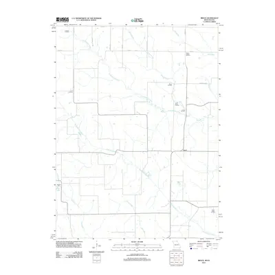
2012 Map of Brock
USGS Topo · Published 2012About this map
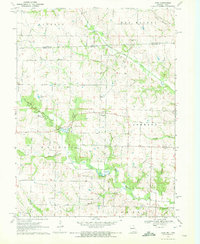
The North Wyaconda River and South Wyaconda River dominate this landscape in Scotland County, Missouri, carving parallel paths across a rural terrain defined by agricultural grids and small family burial grounds. The tiny settlement of Brock serves as the central focal point, situated at the intersection of local routes near the river bends. This 2012 survey provides a detailed look at the distribution of genealogy-rich sites, such as Hubbard Cemetery, Trinity Cemetery, and the Brown Cottage Cemetery, which are scattered throughout the countryside. Water features like Billups Branch, Cook Creek, and the Bechtel Dam near A B Lake reveal the local drainage patterns and water management systems. The grid of roads, including Valley Ave and Wheat Ave, illustrates how the land was partitioned for farming and residency.
Find a feature on this map
26 named features on this map. Tap any name to fly to it.
Don’t see what you’re looking for? This feature index may not catch every label — zoom into the map to look around manually.
Map Details
Editions of this 2012 Brock Map
This is the sole edition of this map. No revisions or reprints were ever made.
Other maps of this area

1903 · Edina
USGS Topo · 1:125,000

1954 · Centerville
USGS Topo · 1:250,000

1957 · Centerville
USGS Topo · 1:250,000

1958 · Centerville
USGS Topo · 1:250,000

1965 · Memphis
USGS Topo · 1:24,000
1965 · Arbela
USGS Topo · 1:24,000

1966 · Downing
USGS Topo · 1:24,000
1970 · Cantril
USGS Topo · 1:24,000
1970 · Brock
USGS Topo · 1:24,000
1970 · Azen
USGS Topo · 1:24,000