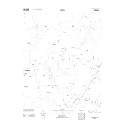
2013 Map of Brockdell
USGS Topo · Published 2013About this map
Sequatchie College stands near the intersection of Old Highway 28 and the modern thoroughfare in this portion of the Cumberland Plateau. The settlement pattern here is defined by long, parallel ridges such as Rainey Ridge and Chinquapin Ridge, with development clustered along the narrow valleys and gaps. The map documents rural centers like Brockdell and Lusk, while the rail history of the area is represented by Lees Station near the Sequatchie River. Topographic features like Rains Gulf and Sullivan Cove reveal the complex geography of the plateau's edge. Researchers will find numerous family-named landmarks and roads, including Ed Bowling Rd and Rosco Keener Rd, illustrating the deep-rooted local genealogy of the region. The map also captures the high-elevation waters of Meadow Creek Lake and the drainage of Cane Creek through Devils Neck.
Find a feature on this map
108 named features on this map. Tap any name to fly to it.
Don’t see what you’re looking for? This feature index may not catch every label — zoom into the map to look around manually.
Map Details
Editions of this 2013 Brockdell Map
This is the sole edition of this map. No revisions or reprints were ever made.
Other maps of this area

1888 · Chattanooga
USGS Topo · 1:125,000

1892 · Pikeville
USGS Topo · 1:125,000

1893 · Chattanooga
USGS Topo · 1:125,000

1895 · Pikeville
USGS Topo · 1:125,000

1909 · Sequatchie Valley
USGS Topo · 1:62,500

1910 · Pikeville
USGS Topo · 1:62,500

1935 · Brockdell
USGS Topo · 1:24,000

1935 · Billingsley Gap
USGS Topo · 1:24,000

1935 · Brayton
USGS Topo · 1:24,000

1935 · Mount Airy
USGS Topo · 1:24,000