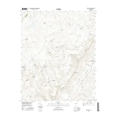
2016 Map of Brockdell
USGS Topo · Published 2016About this map
The Cumberland Escarpment dominates this portion of Bledsoe County, creating a sharp geographical divide between the high plateau and the Sequatchie Valley below. This survey captures the rural character of the region in the early 21st century, where small communities like Brockdell and Lees Station are linked by winding roads such as Old State Hwy 28. The terrain is defined by dramatic elevation changes, moving from the heights of Sheepnose Mtn and Basin Mtn down into deep recesses like Penitentiary Gulf and Lees Gulf.
Find a feature on this map
86 named features on this map. Tap any name to fly to it.
Don’t see what you’re looking for? This feature index may not catch every label — zoom into the map to look around manually.
Map Details
Editions of this 2016 Brockdell Map
This is the sole edition of this map. No revisions or reprints were ever made.
Other maps of this area

1888 · Chattanooga
USGS Topo · 1:125,000

1892 · Pikeville
USGS Topo · 1:125,000

1893 · Chattanooga
USGS Topo · 1:125,000

1895 · Pikeville
USGS Topo · 1:125,000

1909 · Sequatchie Valley
USGS Topo · 1:62,500

1910 · Pikeville
USGS Topo · 1:62,500

1935 · Brockdell
USGS Topo · 1:24,000

1935 · Billingsley Gap
USGS Topo · 1:24,000

1935 · Brayton
USGS Topo · 1:24,000

1935 · Mount Airy
USGS Topo · 1:24,000