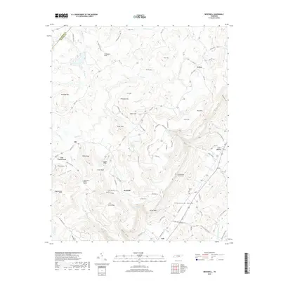
2019 Map of Brockdell
USGS Topo · Published 2019About this map
Old Cumberland and the Cumberland Escarpment define the geography of this Bledsoe County landscape, where the plateau surface meets the dramatic descent into the Sequatchie Valley. This 2019 survey captures a complex network of ridges and hollows, including Rainey Ridge, Brock Hollow, and Higginbotham Ridge. The drainage patterns are clearly delineated, showing how waters from Slaytons Fork and Meadow Cr eventually contribute to the region's river systems across the Tennessee Valley Divide.
Find a feature on this map
93 named features on this map. Tap any name to fly to it.
Don’t see what you’re looking for? This feature index may not catch every label — zoom into the map to look around manually.
Map Details
Editions of this 2019 Brockdell Map
This is the sole edition of this map. No revisions or reprints were ever made.
Other maps of this area

1888 · Chattanooga
USGS Topo · 1:125,000

1892 · Pikeville
USGS Topo · 1:125,000

1893 · Chattanooga
USGS Topo · 1:125,000

1895 · Pikeville
USGS Topo · 1:125,000

1909 · Sequatchie Valley
USGS Topo · 1:62,500

1910 · Pikeville
USGS Topo · 1:62,500

1935 · Brockdell
USGS Topo · 1:24,000

1935 · Billingsley Gap
USGS Topo · 1:24,000

1935 · Brayton
USGS Topo · 1:24,000

1935 · Mount Airy
USGS Topo · 1:24,000