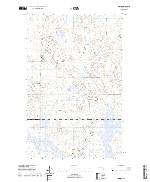
2024 Map of Brocket
USGS Topo · Published 2024About this map
Brocket serves as the central hub of this prairie landscape, where the intersection of N Brocket Dr and local section roads marks the heart of the community. The surrounding rural terrain is defined by its numerous small basins and glacial depressions, characteristic of the region's wetland ecology. Significant conservation tracts, including the Nelson County Waterfowl Production Area and the Ncwpa, protect these aquatic habitats. Genealogists and local historians can locate several family and community burial grounds, such as Saint Joseph Cem, Vaage Cem, and Hoff Cem, which are scattered among the farmsteads. The eastern portion of the quadrangle features larger water bodies like McHugh Slough and Clear Lake, illustrating the transition from tilled fields to the complex wetland systems of Nelson and Ramsey counties.
Find a feature on this map
26 named features on this map. Tap any name to fly to it.
Don’t see what you’re looking for? This feature index may not catch every label — zoom into the map to look around manually.
Map Details
Editions of this 2024 Brocket Map
This is the sole edition of this map. No revisions or reprints were ever made.
Other maps of this area

1953 · Devils Lake
USGS Topo · 1:250,000

1956 · Devils Lake
USGS Topo · 1:250,000

1970 · Lakota
USGS Topo · 1:24,000
1970 · Bartlett
USGS Topo · 1:24,000

1971 · Michigan West
USGS Topo · 1:24,000

1971 · Brocket
USGS Topo · 1:24,000

1971 · Pelto
USGS Topo · 1:24,000

1971 · Lakota NW
USGS Topo · 1:24,000

1972 · Edmore SW
USGS Topo · 1:24,000

1972 · Adams SW
USGS Topo · 1:24,000