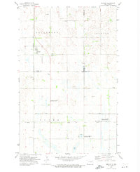
1971 Map of Brocket
USGS Topo · Published 1974About this map
Brocket serves as the primary hub of this North Dakota prairie landscape, situated at the junction of the Burlington Northern railroad and several local roads. The map illustrates a region defined by its agricultural layout and numerous water features, including Clear Lake and several designated zones of the National Waterfowl Production Area. These protected lands are interspersed with township sections like Lillehoff, Sauter, and Clara, reflecting the organized settlement of the late 19th and early 20th centuries.
Find a feature on this map
19 named features on this map. Tap any name to fly to it.
Don’t see what you’re looking for? This feature index may not catch every label — zoom into the map to look around manually.
Map Details
Editions of this 1971 Brocket Map
This is the sole edition of this map. No revisions or reprints were ever made.
Other maps of this area
1953 · Devils Lake
USGS Topo · 1:250,000
1956 · Devils Lake
USGS Topo · 1:250,000
1970 · Lakota
USGS Topo · 1:24,000
1970 · Bartlett
USGS Topo · 1:24,000
1971 · Michigan West
USGS Topo · 1:24,000
1971 · Pelto
USGS Topo · 1:24,000
1971 · Lakota NW
USGS Topo · 1:24,000
1972 · Edmore SW
USGS Topo · 1:24,000
1972 · Adams SW
USGS Topo · 1:24,000
1972 · Lawton
USGS Topo · 1:24,000