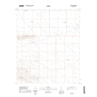
2023 Map of Brockman
USGS Topo · Published 2023About this map
Brockman sits at the northern edge of this high-desert landscape in Grant County, where the terrain is defined by the significant elevation of the Brockman Hills and Coyote Hills. This 2023 survey illustrates a region where water management is central to the land's utility, evidenced by the distribution of Brockman Tank, Coyote Tank, and Vista Tank. These catchment features suggest the area's continued use for livestock or land management in an arid environment. Most notably, the Continental Divide National Scenic Trail winds through the southwestern section of the map, crossing the undulating slopes near the Coyote Hills. The grid of the Public Land Survey System is clearly marked, showing the boundaries between t25s r16w, t25s r15w, t26s r16w, and t26s r15w, which orient the researcher within this remote portion of New Mexico.
Find a feature on this map
11 named features on this map. Tap any name to fly to it.
Don’t see what you’re looking for? This feature index may not catch every label — zoom into the map to look around manually.
Map Details
Editions of this 2023 Brockman Map
This is the sole edition of this map. No revisions or reprints were ever made.
Other maps of this area

1918 · Hachita
USGS Topo · 1:62,500

1918 · Playas
USGS Topo · 1:62,500

1919 · Playas
USGS Topo · 1:62,500

1954 · Silver City
USGS Topo · 1:250,000

1955 · Douglas
USGS Topo · 1:250,000

1958 · Silver City
USGS Topo · 1:250,000

1959 · Douglas
USGS Topo · 1:250,000

1961 · Douglas
USGS Topo · 1:250,000

1962 · Silver City
USGS Topo · 1:250,000

1964 · Douglas
USGS Topo · 1:250,000