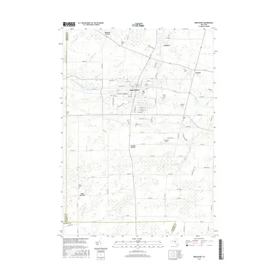
2016 Map of Brockport
USGS Topo · Published 2016About this map
The Erie Canal cuts directly through the heart of Brockport, anchoring a landscape that bridges the historical transport corridor with the academic campus of SUNY Coll at Brockport. This 2016 survey illustrates the persistent importance of the canal in defining the town's grid, with streets like W Canal Rd and E Canal Rd following its path. Beyond the village center, the township of Sweden Center is characterized by a series of agricultural and aviation features, including the Ledgedale Airpark and the Mc Kinney Airport.
Find a feature on this map
93 named features on this map. Tap any name to fly to it.
Don’t see what you’re looking for? This feature index may not catch every label — zoom into the map to look around manually.
Map Details
Editions of this 2016 Brockport Map
This is the sole edition of this map. No revisions or reprints were ever made.
Other maps of this area

1897 · Albion
USGS Topo · 1:62,500

1897 · Oak Orchard
USGS Topo · 1:62,500

1899 · Hamlin
USGS Topo · 1:62,500

1899 · Brockport
USGS Topo · 1:62,500

1932 · Hamlin
USGS Topo · 1:24,000

1932 · Spencerport
USGS Topo · 1:24,000

1934 · Spencerport
USGS Topo · 1:24,000

1934 · Brockport
USGS Topo · 1:24,000
1934 · Hilton
USGS Topo · 1:24,000

1934 · Clifton
USGS Topo · 1:24,000