
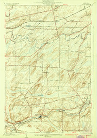
1934 Map of Clifton
USGS Topo · Published 1934About this map
Scottsville and Mumford anchor the southern reaches of this landscape, where the Oatka Creek carves a deep valley through the townships of Wheatland and Chili. The 1930s era was defined by a dense network of transit and local education, evidenced by numerous numbered schoolhouses like School No 5 and School No 10 scattered across the rural acreage. Along the northern corridor, the New York Central Railroad and West Shore Railroad converge at Chili Junction, supporting a series of small trackside settlements including Chili Station and North Chili.
Find a feature on this map
51 named features on this map. Tap any name to fly to it.
Don’t see what you’re looking for? This feature index may not catch every label — zoom into the map to look around manually.
Map Details
Editions of this 1934 Clifton Map
2 editions found
Other maps of this area

1895 · Rochester
USGS Topo · 1:62,500

1898 · Rochester
USGS Topo · 1:62,500

1899 · Brockport
USGS Topo · 1:62,500

1901 · Honeoye
USGS Topo · 1:62,500

1904 · Caledonia
USGS Topo · 1:62,500

1904 · Honeoye
USGS Topo · 1:62,500

1912 · Rochester
USGS Topo · 1:62,500

1920 · Rochester
USGS Topo · 1:62,500

1931 · Rochester West
USGS Topo · 1:24,000

1932 · Spencerport
USGS Topo · 1:24,000