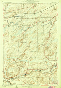
1934 Map of Clifton
USGS Topo · Published 1934About this map
Oatka Creek winds through the southern portion of this region, providing the drainage for settlements like Garbutt and Mumford during the mid-1930s. The landscape is defined by its agrarian roots and the essential infrastructure of the New York Central and Pennsylvania railroads, which facilitated movement between the smaller hubs of Clifton and Scottsville. Local education and community life are well-documented through a dense network of numbered schoolhouses, such as School No 10 near the sawmill, and historic religious centers like Chesbro Seminary in North Chili. Genealogists will find several burial grounds mapped with precision, including the Quaker Cem and Fellows Cem. To the north, Black Creek meanders toward Buckbee Corners, while an Airway Beacon near the center of the sheet highlights the early integration of aviation infrastructure into the rural New York countryside.
Find a feature on this map
61 named features on this map. Tap any name to fly to it.
Don’t see what you’re looking for? This feature index may not catch every label — zoom into the map to look around manually.
Map Details
Editions of this 1934 Clifton Map
2 editions found

Other maps of this area

1895 · Rochester
USGS Topo · 1:62,500

1898 · Rochester
USGS Topo · 1:62,500

1899 · Brockport
USGS Topo · 1:62,500

1901 · Honeoye
USGS Topo · 1:62,500

1904 · Caledonia
USGS Topo · 1:62,500

1904 · Honeoye
USGS Topo · 1:62,500

1912 · Rochester
USGS Topo · 1:62,500

1920 · Rochester
USGS Topo · 1:62,500

1931 · Rochester West
USGS Topo · 1:24,000

1932 · Spencerport
USGS Topo · 1:24,000