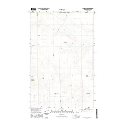
2017 Map of Brockway Spring
USGS Topo · Published 2017About this map
Brockway Spring serves as a focal point in this remote corner of northeast Montana, situated along the border of Valley and Daniels counties. The landscape is defined by its deep coulees, where seasonal drainage patterns have carved significant depressions into the plains. Notable formations include Brockway Coulee, Morgan Coulee, and Flaherty Coulee to the east, while Swift Coulee marks the southern portion of the survey. The intermittent waters of Coal Cr meander through the northern sections, tracing the natural contours of the land. A sparse network of gravel and dirt roads, such as N Bench Rd, Coal Creek Rd, and Thievin Rd, provides the only access through this expansive grazing and agricultural territory, highlighting the isolation of these high-plains townships.
Find a feature on this map
18 named features on this map. Tap any name to fly to it.
Don’t see what you’re looking for? This feature index may not catch every label — zoom into the map to look around manually.
Map Details
Editions of this 2017 Brockway Spring Map
This is the sole edition of this map. No revisions or reprints were ever made.
Other maps of this area

1954 · Wolf Point
USGS Topo · 1:250,000

1954 · Glasgow
USGS Topo · 1:250,000

1957 · Glasgow
USGS Topo · 1:250,000

1958 · Wolf Point
USGS Topo · 1:250,000

1958 · Glasgow
USGS Topo · 1:250,000

1973 · Horseshoe Basin
USGS Topo · 1:24,000

1973 · Brockway Spring
USGS Topo · 1:24,000

1973 · Flaherty Coulee
USGS Topo · 1:24,000

1973 · Richland
USGS Topo · 1:24,000

1973 · Kaminski Hill
USGS Topo · 1:24,000