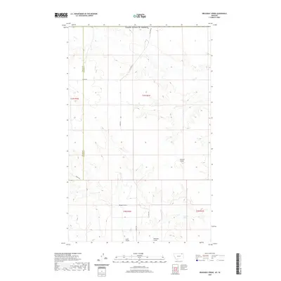
2020 Map of Brockway Spring
USGS Topo · Published 2020About this map
Brockway Spring serves as a focal point in this high plains landscape of northeastern Montana, where the topography is defined by the drainage patterns of several major coulees. The terrain is marked by deep incisions from Flaherty Coulee, Morgan Coulee, and Swift Coulee, which flow toward the southern portion of the quadrangle. These natural features dictated the early settlement and road patterns, as seen in the placement of Coal Creek Rd and N Bench Rd along the more stable high ground. The northern edge of the sheet follows the international boundary of the United States of America, while the western side highlights the border between Valley and Daniels Counties. The drainage of Coal Cr provides the primary watercourse for the northern sections, illustrating the persistent importance of limited water sources in this dry ranching country.
Find a feature on this map
16 named features on this map. Tap any name to fly to it.
Don’t see what you’re looking for? This feature index may not catch every label — zoom into the map to look around manually.
Map Details
Editions of this 2020 Brockway Spring Map
This is the sole edition of this map. No revisions or reprints were ever made.
Other maps of this area

1954 · Wolf Point
USGS Topo · 1:250,000

1954 · Glasgow
USGS Topo · 1:250,000

1957 · Glasgow
USGS Topo · 1:250,000

1958 · Wolf Point
USGS Topo · 1:250,000

1958 · Glasgow
USGS Topo · 1:250,000

1973 · Horseshoe Basin
USGS Topo · 1:24,000

1973 · Brockway Spring
USGS Topo · 1:24,000

1973 · Flaherty Coulee
USGS Topo · 1:24,000

1973 · Richland
USGS Topo · 1:24,000

1973 · Kaminski Hill
USGS Topo · 1:24,000