
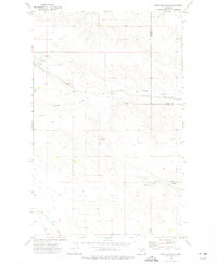
1973 Map of Brockway Spring
USGS Topo · Published 1976About this map
The international boundary between the Canada United States border and the state line of Saskatchewan Montana defines the northern edge of this high plains landscape. This 1973 survey reveals a terrain deeply etched by seasonal drainage systems, including Swift Coulee, Morgan Coulee, and Flaherty Coulee, which traverse the open range. The map provides a detailed look at the resource-based economy of the region, specifically marking locations for Coal extraction and a Gravel Pit.
Find a feature on this map
13 named features on this map. Tap any name to fly to it.
Don’t see what you’re looking for? This feature index may not catch every label — zoom into the map to look around manually.
Map Details
Editions of this 1973 Brockway Spring Map
This is the sole edition of this map. No revisions or reprints were ever made.
Other maps of this area

1954 · Wolf Point
USGS Topo · 1:250,000

1954 · Glasgow
USGS Topo · 1:250,000

1957 · Glasgow
USGS Topo · 1:250,000

1958 · Wolf Point
USGS Topo · 1:250,000

1958 · Glasgow
USGS Topo · 1:250,000

1973 · Horseshoe Basin
USGS Topo · 1:24,000

1973 · Flaherty Coulee
USGS Topo · 1:24,000

1973 · Richland
USGS Topo · 1:24,000

1973 · Kaminski Hill
USGS Topo · 1:24,000
1973 · Glentana East
USGS Topo · 1:24,000