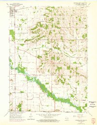
1962 Map of Brodhead East
USGS Topo · Published 1972About this map
The Sugar River meanders through the southern half of this landscape, forming a wide, fertile valley that historically defined the development of Rock County. Settlement patterns here are anchored by the town of Brodhead in the northwest and Orfordville in the northeast, connected by a network of rural roads that serve the surrounding agricultural townships of Spring Valley and Avon. This 1962 survey, updated with 1971 aerial data, captures the rural infrastructure of the mid-century, including the Chicago Milwaukee St Paul and Pacific railroad corridor and local social centers like the Avon Townhall.
Find a feature on this map
22 named features on this map. Tap any name to fly to it.
Don’t see what you’re looking for? This feature index may not catch every label — zoom into the map to look around manually.
Map Details
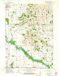
Editions of this 1962 Brodhead East Map
2 editions found
Other maps of this area

1891 · Janesville
USGS Topo · 1:62,500

1893 · Janesville
USGS Topo · 1:62,500

1893 · Brodhead
USGS Topo · 1:62,500

1918 · Rockford
USGS Topo · 1:62,500

1932 · Pecatonica
USGS Topo · 1:62,500

1936 · Pecatonica
USGS Topo · 1:62,500

1938 · Rockford
USGS Topo · 1:62,500

1954 · Rockford
USGS Topo · 1:250,000

1955 · Rockford
USGS Topo · 1:250,000

1958 · Rockford
USGS Topo · 1:250,000