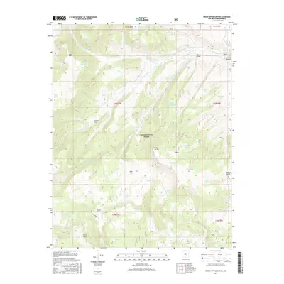
2017 Map of Broke Off Mountain
USGS Topo · Published 2017About this map
Carson National Forest encompasses this high-altitude landscape in Rio Arriba County, dominated by the prominent summit of Broke Off Mtn. The terrain is defined by deep drainage systems like Cañada Rio Grande and Dry Canyon, which cut through the uplifted tablelands of Olguin Mesa. Water management for ranching and wildlife is a primary feature of the area, evidenced by a dense network of collection points such as Olguin Pit Tanks, Julian Draw Tank, and Alire Tank Number 1.
Find a feature on this map
49 named features on this map. Tap any name to fly to it.
Don’t see what you’re looking for? This feature index may not catch every label — zoom into the map to look around manually.
Map Details
Editions of this 2017 Broke Off Mountain Map
This is the sole edition of this map. No revisions or reprints were ever made.
Other maps of this area

1918 · Tusas
USGS Topo · 1:125,000

1954 · Aztec
USGS Topo · 1:250,000

1955 · Cebolla
USGS Topo · 1:62,500

1955 · Brazos Peak
USGS Topo · 1:62,500

1958 · Aztec
USGS Topo · 1:250,000

1962 · Aztec
USGS Topo · 1:250,000
1963 · Los Pinos
USGS Topo · 1:24,000
1963 · Bighorn Peak
USGS Topo · 1:24,000

1963 · Broke Off Mountain
USGS Topo · 1:24,000

1963 · Burned Mountain
USGS Topo · 1:24,000