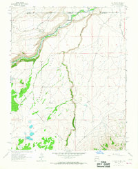
1963 Map of Los Pinos
USGS Topo · Published 1967About this map
Rio de los Pinos and the Rio San Antonio dominate this high-altitude landscape along the border of Colorado and New Mexico in the early 1960s. The Denver and Rio Grande Western railroad tracks wind through the northern terrain, passing by the small settlement of Lava with its functional Water Tower. This area of the Carson National Forest is defined by sharp elevation changes, notably across the expansive Mesa Pina Betal. To the west, Chino Peak stands above Chino Dry Lake, while the southern reaches of the map include the remote waters of Laguna Larga. Isolated outposts like Los Pinos and Ortiz are connected by a network of primitive routes, including a Jeep Trail and Pack Trail, reflecting the difficult access and ranching heritage of the Cañada de los Ranchos.
Find a feature on this map
21 named features on this map. Tap any name to fly to it.
Don’t see what you’re looking for? This feature index may not catch every label — zoom into the map to look around manually.
Map Details
Editions of this 1963 Los Pinos Map
2 editions found
Other maps of this area

1918 · Tusas
USGS Topo · 1:125,000

1922 · Conejos
USGS Topo · 1:125,000

1945 · Durango
USGS Topo · 1:250,000

1953 · Durango
USGS Topo · 1:250,000

1954 · Durango
USGS Topo · 1:250,000

1954 · Raton
USGS Topo · 1:250,000

1954 · Trinidad
USGS Topo · 1:250,000

1954 · Aztec
USGS Topo · 1:250,000

1955 · Trinidad
USGS Topo · 1:250,000

1958 · Raton
USGS Topo · 1:250,000