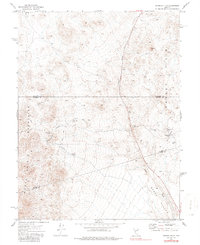
1972 Map of Broken Hills
USGS Topo · Published 1986About this map
Broken Hills remains as a focal point of former activity on this high-desert Nevada landscape, where the mining industry once left its mark across the Broken Hills range. Grounded in the 1970s, the map illustrates a network of resource extraction and water management, featuring the Broken Hills Mine and the Kaiser Mine tucked into the eastern slopes of the Monte Cristo Mountains. An Aqueduct and multiple wells, including Kaiser Well and Kaiser Well No 2, highlight the critical infrastructure required to support operations in this arid environment near the Gabbs Valley. The terrain is marked by isolated Prospects and a solitary Grave, offering researchers a look at the sparse but persistent human presence in a region defined by its geology. The intersection of three counties—Churchill, Mineral, and Nye—runs through these flats, anchored by landforms like Bell Flat and the peak of Mt Anna.
Find a feature on this map
17 named features on this map. Tap any name to fly to it.
Don’t see what you’re looking for? This feature index may not catch every label — zoom into the map to look around manually.
Map Details
Editions of this 1972 Broken Hills Map
2 editions found
Other maps of this area

1907 · Tonopah
USGS Topo · 1:250,000

1908 · Tonopah
USGS Topo · 1:250,000

1908 · Carson Sink
USGS Topo · 1:250,000

1909 · Hawthorne
USGS Topo · 1:250,000

1910 · Carson Sink
USGS Topo · 1:250,000

1911 · Hawthorne
USGS Topo · 1:250,000

1915 · Hawthorne
USGS Topo · 1:250,000

1948 · Paradise Peak
USGS Topo · 1:62,500

1948 · Walker Lake
USGS Topo · 1:250,000

1950 · Paradise Peak
USGS Topo · 1:62,500