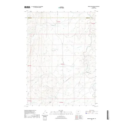
2017 Map of Broken Horn Creek
USGS Topo · Published 2017About this map
Broken Horn anchors this high-plains landscape in northern Natrona County, where the southern reaches of the Powder River Basin reveal a complex network of drainage and ranching infrastructure. The S Fork Powder River carves through the eastern portion of the quadrangle, joined by seasonal tributaries including Broken Horn Cr and Lone Bear Cr. The terrain is defined by its water sources, from the isolated Turkey Springs to the Neff Reservoir, illustrating the vital importance of water management in this arid cattle country.
Find a feature on this map
21 named features on this map. Tap any name to fly to it.
Don’t see what you’re looking for? This feature index may not catch every label — zoom into the map to look around manually.
Map Details
Editions of this 2017 Broken Horn Creek Map
This is the sole edition of this map. No revisions or reprints were ever made.
Other maps of this area

1955 · Arminto
USGS Topo · 1:250,000

1958 · Arminto
USGS Topo · 1:250,000

1961 · Barnum
USGS Topo · 1:62,500

1961 · TTT Ranch
USGS Topo · 1:24,000

1961 · Wall Creek
USGS Topo · 1:24,000

1962 · Arminto
USGS Topo · 1:250,000

1968 · Willow Creek School
USGS Topo · 1:24,000

1968 · Camel Hump Reservoir
USGS Topo · 1:24,000

1968 · Big Sulfur Draw
USGS Topo · 1:24,000

1968 · Fiftymile Flat
USGS Topo · 1:24,000