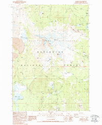
1988 Map of Broken Top
USGS Topo · Published 1988About this map
Broken Top and the surrounding high-altitude terrain of the Deschutes National Forest dominate this late-twentieth-century topographical survey. The landscape is defined by the remnants of volcanic activity and glacial movement, featuring the Bend Glacier and Crook Glacier carved into the mountain's northeast face. The map reveals a complex hydrologic system where high-country basins such as Green Lakes and Todd Lake feed various branches of North Fork Tumalo Creek and South Fork Squaw Creek. In the southern reaches, the Mt. Bachelor Ski Area and Egan Lodge indicate the area's development for recreation near Dutchman Flat. This provisional map provides a detailed view of the Three Sisters Wilderness boundary, showing the relationship between protected primitive lands and the seasonal infrastructures that support tourism in this part of the Cascades.
Find a feature on this map
41 named features on this map. Tap any name to fly to it.
Don’t see what you’re looking for? This feature index may not catch every label — zoom into the map to look around manually.
Map Details
Editions of this 1988 Broken Top Map
3 editions found
Other maps of this area

1929 · Three Sisters
USGS Topo · 1:125,000

1930 · Maiden Peak
USGS Topo · 1:125,000

1932 · Three Sisters
USGS Topo · 1:125,000

1934 · Maiden Peak
USGS Topo · 1:125,000

1955 · Crescent
USGS Topo · 1:250,000

1955 · Bend
USGS Topo · 1:250,000

1957 · Crescent
USGS Topo · 1:250,000

1957 · Bend
USGS Topo · 1:250,000

1958 · Crescent
USGS Topo · 1:250,000

1958 · Bend
USGS Topo · 1:250,000