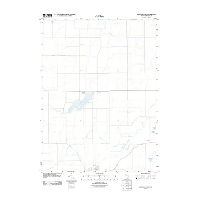
2011 Map of Bronson North
USGS Topo · Published 2011About this map
Swan Creek and its many tributaries, including Little Swan Creek and Riley Creek, define the drainage patterns of this Branch County landscape. The southern edge of the map is anchored by the community of Bronson, while the settlement of Matteson lies further north near the shores of Matteson Lake. This area of southern Michigan is characterized by a high concentration of small kettle lakes, such as Palmitere Lake, Dorsey Lake, and Bassett Lake, which are interspersed throughout the agricultural grid. Genealogists and local historians can locate several burial sites within this territory, notably the Matteson Cemetery situated west of the lake and the York Cemetery located further east. The map illustrates a mature rural road network that connects these small water bodies and historical centers, reflecting the enduring township structure of the region.
Find a feature on this map
11 named features on this map. Tap any name to fly to it.
Don’t see what you’re looking for? This feature index may not catch every label — zoom into the map to look around manually.
Map Details
Editions of this 2011 Bronson North Map
This is the sole edition of this map. No revisions or reprints were ever made.
Other maps of this area

1918 · Union City
USGS Topo · 1:62,500

1918 · Leonidas
USGS Topo · 1:62,500

1944 · Leonidas
USGS Topo · 1:62,500

1947 · Union City
USGS Topo · 1:62,500

1947 · Leonidas
USGS Topo · 1:62,500

1950 · Leonidas
USGS Topo · 1:62,500

1950 · Union City
USGS Topo · 1:62,500

1953 · Fort Wayne
USGS Topo · 1:250,000

1956 · Fort Wayne
USGS Topo · 1:250,000

1958 · Grand Rapids
USGS Topo · 1:250,000