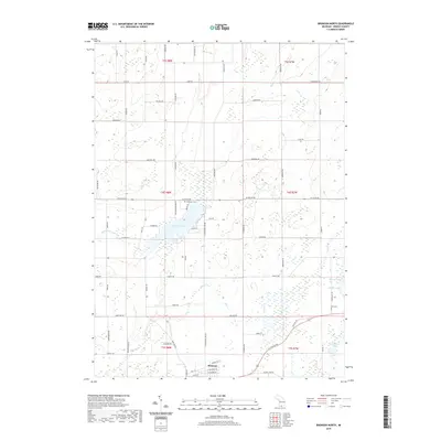
2019 Map of Bronson North
USGS Topo · Published 2019About this map
Bronson anchors the southern boundary of this Branch County landscape, where the town's industrial and residential grid meets a network of glacial lakes and creek systems. To the north, Matteson Lake serves as a central geographical landmark, surrounded by private access roads like W Shore Dr and Fischers Hideaway Rd. The terrain is defined by its drainage patterns, with Riley Cr, Swan Cr, and Little Swan Cr winding through the countryside alongside small water bodies such as Dorsey Lake and Bassett Lake. For researchers and genealogists, the map identifies specific points of local history including Matteson Cem and York Cem, situated among family-named thoroughfares like Arbogast Rd and N Matteson Lake Rd. The map illustrates the transition from the structured street plan of Bronson to the section lines of the surrounding townships.
Find a feature on this map
69 named features on this map. Tap any name to fly to it.
Don’t see what you’re looking for? This feature index may not catch every label — zoom into the map to look around manually.
Map Details
Editions of this 2019 Bronson North Map
This is the sole edition of this map. No revisions or reprints were ever made.
Other maps of this area

1918 · Union City
USGS Topo · 1:62,500

1918 · Leonidas
USGS Topo · 1:62,500

1944 · Leonidas
USGS Topo · 1:62,500

1947 · Union City
USGS Topo · 1:62,500

1947 · Leonidas
USGS Topo · 1:62,500

1950 · Leonidas
USGS Topo · 1:62,500

1950 · Union City
USGS Topo · 1:62,500

1953 · Fort Wayne
USGS Topo · 1:250,000

1956 · Fort Wayne
USGS Topo · 1:250,000

1958 · Grand Rapids
USGS Topo · 1:250,000