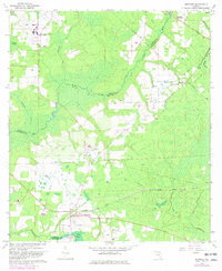
1966 Map of Brooker
USGS Topo · Published 1981About this map
The Seaboard Coast Line railroad anchors the small community of Brooker as it appeared in the mid-1960s, marking a transition between the northern Florida timberlands and agricultural fields. This area on the border of Union, Bradford, and Alachua Counties is defined by the winding course of the New River and its numerous tributaries like Fivemile Creek and Richard Creek. A notable concentration of community landmarks, including the Mount Vernon Ch, New River Ch, and the Long Bridge Community Ch, highlights the rural social fabric of the era.
Find a feature on this map
33 named features on this map. Tap any name to fly to it.
Don’t see what you’re looking for? This feature index may not catch every label — zoom into the map to look around manually.
Map Details
Editions of this 1966 Brooker Map
4 editions found
Other maps of this area

1918 · Lawtey
USGS Topo · 1:62,500

1941 · Starke
USGS Topo · 1:62,500

1948 · Starke
USGS Topo · 1:50,000

1949 · Sampson
USGS Topo · 1:24,000

1949 · Waldo
USGS Topo · 1:24,000

1949 · Starke
USGS Topo · 1:62,500

1954 · Gainesville
USGS Topo · 1:250,000

1954 · Valdosta
USGS Topo · 1:250,000

1958 · Valdosta
USGS Topo · 1:250,000

1958 · Gainesville
USGS Topo · 1:250,000