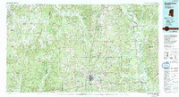
1984 Map of Brookhaven
USGS Topo · Published 1991About this map
The Homochitto National Forest and the Pearl River valley anchor this mid-1980s look at south-central Mississippi. The Illinois Central Gulf railroad serves as a central artery, connecting key trade and transport hubs like Brookhaven, Hazlehurst, and Wesson. This corridor represents the region's historic dependence on rail for timber and agricultural distribution, visible in the proximity of the State Agricultural and Forestry Experiment Station and rural settlements such as Union Church.
Find a feature on this map
94 named features on this map. Tap any name to fly to it.
Don’t see what you’re looking for? This feature index may not catch every label — zoom into the map to look around manually.
Map Details
Editions of this 1984 Brookhaven Map
2 editions found

Other maps of this area

1903 · Jackson
USGS Topo · 1:125,000

1906 · Florence
USGS Topo · 1:62,500

1908 · Florence
USGS Topo · 1:62,500

1937 · Terry
USGS Topo · 1:48,000

1939 · Yokena
USGS Topo · 1:62,500

1939 · Lorman
USGS Topo · 1:62,500

1943 · Terry
USGS Topo · 1:62,500

1953 · Hattiesburg
USGS Topo · 1:250,000

1953 · Meridian
USGS Topo · 1:250,000

1953 · Natchez
USGS Topo · 1:250,000