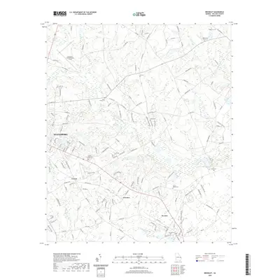
2020 Map of Brooklet
USGS Topo · Published 2020About this map
Statesboro and the neighboring community of Brooklet anchor this portion of Bulloch County, where the landscape is defined by the headwaters of Mill Creek and Upper Black Cr. The settlement pattern follows a network of rural roads and county routes, connecting smaller locales like Pretoria and Grimshaw. This area is particularly dense with genealogical sites, including family-named landmarks like the Beasley Cem, Hodges Cem, and Lee Cem. Significant community hubs appear in the form of the Elmer Church Cem and the Corinth - Leefield Cem, while the Statesboro-Bulloch County Airport marks the northwestern corner of the quadrangle. The map reveals the hydrology of the coastal plain, with numerous ponds such as Lee Pond and Martin Pond dotting the drainages between agricultural tracts and timberlands.
Find a feature on this map
140 named features on this map. Tap any name to fly to it.
Don’t see what you’re looking for? This feature index may not catch every label — zoom into the map to look around manually.
Map Details
Editions of this 2020 Brooklet Map
This is the sole edition of this map. No revisions or reprints were ever made.
Other maps of this area

1918 · Oliver
USGS Topo · 1:62,500

1920 · Statesboro
USGS Topo · 1:62,500

1920 · Oliver
USGS Topo · 1:62,500

1921 · Brooklet
USGS Topo · 1:62,500

1921 · Rocky Ford
USGS Topo · 1:62,500

1943 · Brooklet
USGS Topo · 1:62,500

1943 · Rocky Ford
USGS Topo · 1:62,500

1943 · Millen
USGS Topo · 1:125,000

1943 · Statesboro
USGS Topo · 1:62,500

1943 · Oliver
USGS Topo · 1:62,500