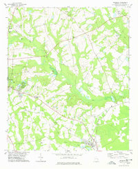
1978 Map of Brooklet
USGS Topo · Published 1978About this map
The city of Statesboro anchors the western edge of this 1970s landscape, where the growing municipal footprint meets the rural reaches of Bulloch County. Toward the southeast, the town of Brooklet sits at a historic crossroads, while smaller settlements like Pretoria and Grimshaw dot the agricultural periphery. The transition from town to timberland is marked by an extensive network of waterways, including Mill Creek, Black Creek, and Newsome Mill Creek, which once powered the local economy. An Old Railroad Grade cutting through the center of the sheet traces the path of former rail commerce that once linked these farming communities.
Find a feature on this map
32 named features on this map. Tap any name to fly to it.
Don’t see what you’re looking for? This feature index may not catch every label — zoom into the map to look around manually.
Map Details
Editions of this 1978 Brooklet Map
This is the sole edition of this map. No revisions or reprints were ever made.
Other maps of this area

1918 · Oliver
USGS Topo · 1:62,500

1920 · Statesboro
USGS Topo · 1:62,500

1920 · Oliver
USGS Topo · 1:62,500

1921 · Brooklet
USGS Topo · 1:62,500

1921 · Rocky Ford
USGS Topo · 1:62,500

1943 · Brooklet
USGS Topo · 1:62,500

1943 · Rocky Ford
USGS Topo · 1:62,500

1943 · Millen
USGS Topo · 1:125,000

1943 · Statesboro
USGS Topo · 1:62,500

1943 · Oliver
USGS Topo · 1:62,500