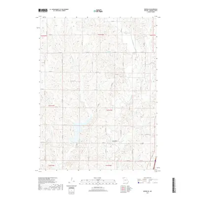
2017 Map of Brooklyn
USGS Topo · Published 2017About this map
Brooklyn sits at the intersection of a complex drainage system in northwestern Missouri, where the meandering paths of W Fork Big Cr and Shain Cr converge. The landscape is defined by the sharp relief of these creek valleys, which have shaped the local road network into a rigid grid of numeric avenues and streets, including W 180th St and W 220th St. This 2017 survey reflects the persistent rural character of Harrison County, documented through small family and community burial grounds such as Allen Cem and Buntin Cem. Several localized water bodies, including Anderson Lake, Hintz Lake, and Craig Lake, are distributed across the township sections, suggesting a history of agricultural water management and recreation within the drainage basins of Little Cr and its various forks.
Find a feature on this map
32 named features on this map. Tap any name to fly to it.
Don’t see what you’re looking for? This feature index may not catch every label — zoom into the map to look around manually.
Map Details
Editions of this 2017 Brooklyn Map
This is the sole edition of this map. No revisions or reprints were ever made.
Other maps of this area

1945 · Mount Ayr
USGS Topo · 1:62,500

1945 · Lamoni
USGS Topo · 1:62,500

1947 · Lamoni
USGS Topo · 1:62,500

1947 · Blythedale
USGS Topo · 1:62,500

1947 · Mount Ayr
USGS Topo · 1:62,500

1948 · Bethany
USGS Topo · 1:62,500

1954 · Centerville
USGS Topo · 1:250,000

1955 · Nebraska City
USGS Topo · 1:250,000

1957 · Nebraska City
USGS Topo · 1:250,000

1957 · Centerville
USGS Topo · 1:250,000