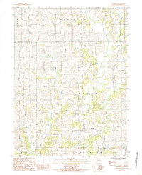
1984 Map of Brooklyn
USGS Topo · Published 1985About this map
Brooklyn stands as the primary community within this rural landscape of northern Missouri, situated amidst a complex network of waterways and township boundaries. The area is defined by the winding course of the West Fork Big Creek and its tributaries, including Shain Creek and Little Creek, which carve through the terrain of Hamilton, Union, and Dallas townships. A small Cem (cemetery) and a designated Pumping Station provide specific points of interest for genealogists and local historians tracing family plots or local infrastructure from the mid-1980s. This survey, produced by the U.S. Geological Survey in cooperation with the Missouri Department of Natural Resources, documents the rural land divisions and water courses just before many such remote landscapes underwent further modernization or consolidation.
Find a feature on this map
12 named features on this map. Tap any name to fly to it.
Don’t see what you’re looking for? This feature index may not catch every label — zoom into the map to look around manually.
Map Details
Editions of this 1984 Brooklyn Map
This is the sole edition of this map. No revisions or reprints were ever made.
Other maps of this area

1945 · Mount Ayr
USGS Topo · 1:62,500

1945 · Lamoni
USGS Topo · 1:62,500

1947 · Lamoni
USGS Topo · 1:62,500

1947 · Blythedale
USGS Topo · 1:62,500

1947 · Mount Ayr
USGS Topo · 1:62,500

1948 · Bethany
USGS Topo · 1:62,500

1954 · Centerville
USGS Topo · 1:250,000

1955 · Nebraska City
USGS Topo · 1:250,000

1957 · Nebraska City
USGS Topo · 1:250,000

1957 · Centerville
USGS Topo · 1:250,000