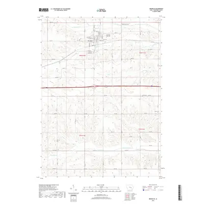
2018 Map of Brooklyn
USGS Topo · Published 2018About this map
Brooklyn serves as the central hub of this Poweshiek County landscape, situated at a junction where the town grid meets a complex network of Iowa creek valleys. The settlement is positioned along the banks of Little Bear Cr, with a town layout featuring historic thoroughfares such as W Des Moines St, Lincoln St, and Jefferson St. This modern survey reveals a deep layer of community heritage through its numerous rural burial grounds, including the International Order of Odd Fellows Cem and Calvary Cem north of town, and the more isolated Harmony Cem and Morrison Cem to the southeast.
Find a feature on this map
54 named features on this map. Tap any name to fly to it.
Don’t see what you’re looking for? This feature index may not catch every label — zoom into the map to look around manually.
Map Details
Editions of this 2018 Brooklyn Map
This is the sole edition of this map. No revisions or reprints were ever made.
Other maps of this area

1954 · Des Moines
USGS Topo · 1:250,000

1956 · Des Moines
USGS Topo · 1:250,000

1957 · Des Moines
USGS Topo · 1:250,000

1968 · Deep River
USGS Topo · 1:24,000

1968 · Brooklyn
USGS Topo · 1:24,000

1968 · Belle Plaine SW
USGS Topo · 1:24,000

1968 · Victor
USGS Topo · 1:24,000

1968 · Hartwick
USGS Topo · 1:24,000

1968 · Barnes City
USGS Topo · 1:24,000

1969 · Des Moines
USGS Topo · 1:250,000