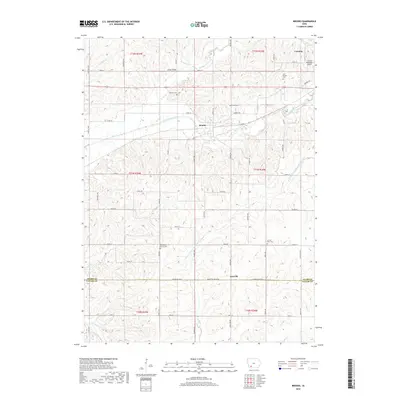
2018 Map of Brooks
USGS Topo · Published 2018About this map
The East Nodaway River and the W Fork One Hundred and Two River shape the agricultural landscape of this southwestern Iowa region. The settlement of Brooks sits near the river bend, while Iveyville marks the southern portion of the quadrangle along the Adams Co Taylor Co line. This 2018 survey reveals a terrain defined by a dense network of country roads, such as Co Rd H54 and Adams Taylor St, which connect dispersed farmsteads and local landmarks. Genealogists will find several burial sites including Old Brooks Cem, Baldwin Cem, and Methodist Grove Cem. The presence of Snider Bridge and the Corning Municipal Airport on the outskirts of Corning highlights the area's modern infrastructure within a traditionally rural setting.
Find a feature on this map
34 named features on this map. Tap any name to fly to it.
Don’t see what you’re looking for? This feature index may not catch every label — zoom into the map to look around manually.
Map Details
Editions of this 2018 Brooks Map
This is the sole edition of this map. No revisions or reprints were ever made.
Other maps of this area

1954 · Omaha
USGS Topo · 1:250,000

1955 · Nebraska City
USGS Topo · 1:250,000

1957 · Nebraska City
USGS Topo · 1:250,000

1957 · Omaha
USGS Topo · 1:250,000

1958 · Omaha
USGS Topo · 1:250,000

1958 · Nebraska City
USGS Topo · 1:250,000

1980 · Corning South
USGS Topo · 1:24,000

1980 · Gravity
USGS Topo · 1:24,000

1980 · Guss
USGS Topo · 1:24,000

1980 · Corning North
USGS Topo · 1:24,000