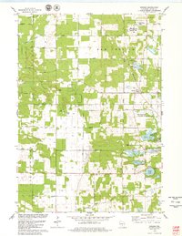
1979 Map of Brooks
USGS Topo · Published 1979About this map
Brooks serves as a central hub for this portion of Adams County, situated along the Chicago and North Western railroad line. The landscape is a complex of agricultural tracts and water features, most notably the Upper Neenah Creek State Fishery Area and a cluster of recreational lakes including Peppermill Lake, Parker Lake, and Goose Lake. Local civic life is anchored by the Townhall and the New Chester Ch, with a Cem located nearby, providing valuable points of reference for genealogists.
Find a feature on this map
51 named features on this map. Tap any name to fly to it.
Don’t see what you’re looking for? This feature index may not catch every label — zoom into the map to look around manually.
Map Details
Editions of this 1979 Brooks Map
This is the sole edition of this map. No revisions or reprints were ever made.
Other maps of this area

1901 · The Dells
USGS Topo · 1:62,500

1902 · Briggsville
USGS Topo · 1:62,500

1957 · Wisconsin Dells
USGS Topo · 1:62,500

1957 · Madison
USGS Topo · 1:250,000

1958 · Briggsville
USGS Topo · 1:62,500

1960 · Madison
USGS Topo · 1:250,000

1961 · Oxford
USGS Topo · 1:62,500

1961 · Adams
USGS Topo · 1:62,500
1975 · Wisconsin Dells NE
USGS Topo · 1:24,000
1975 · Big Spring
USGS Topo · 1:24,000