
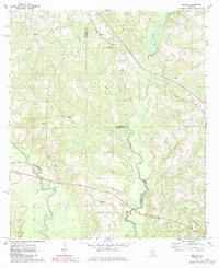
1971 Map of Brooks
USGS Topo · Published 1972About this map
The Sepulga River defines the southwestern corner of this South Alabama landscape, winding through a terrain dominated by the meeting of Conecuh and Covington counties. Rural life in the early 1970s centered around small crossroads communities like Brooks and Cohassett, and the presence of several country churches such as New Home Ch and Antioch Ch reflects the era's deep-rooted community structure.
Find a feature on this map
21 named features on this map. Tap any name to fly to it.
Don’t see what you’re looking for? This feature index may not catch every label — zoom into the map to look around manually.
Map Details
Editions of this 1971 Brooks Map
2 editions found
Other maps of this area

1953 · Andalusia
USGS Topo · 1:250,000

1957 · Andalusia
USGS Topo · 1:250,000

1971 · Industry
USGS Topo · 1:24,000

1971 · River Falls
USGS Topo · 1:24,000

1971 · Mc Kenzie
USGS Topo · 1:24,000

1971 · Red Level
USGS Topo · 1:24,000

1971 · Loango
USGS Topo · 1:24,000

1971 · Garland
USGS Topo · 1:24,000

1982 · Old Town
USGS Topo · 1:24,000
1982 · Brooklyn
USGS Topo · 1:24,000