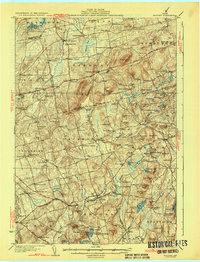
1932 Map of Brooks
USGS Topo · Published 1932About this map
Mount Harris rises as a central landmark in this 1930s landscape of rural Waldo County, where a network of schools and small settlements define the social fabric of the era. The topography is marked by a series of drumlin-like hills such as Plummer Hill and Goodwin Hill, interspersed with water bodies like Passagassawakeag Pond and Toddy Pond. The transport network of the early thirties is visible through Route 139 and the presence of Knox Sta, reflecting the importance of both rail and roadway to these communities. Numerous local schools, including Maple Grove Sch and Washington Sch, are scattered throughout the townships of Jackson, Dixmont, and Brooks, illustrating a period of decentralized education and agriculture. Small-scale industrial sites like Kickerson Mills and the Twombly Mine provide clues to the local economy and land use during this time.
Find a feature on this map
139 named features on this map. Tap any name to fly to it.
Don’t see what you’re looking for? This feature index may not catch every label — zoom into the map to look around manually.
Map Details
Editions of this 1932 Brooks Map
3 editions found

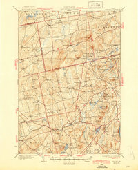
Other maps of this area

1900 · Bucksport
USGS Topo · 1:62,500

1902 · Bucksport
USGS Topo · 1:62,500

1902 · Bangor
USGS Topo · 1:62,500

1902 · Castine
USGS Topo · 1:62,500

1904 · Castine
USGS Topo · 1:62,500

1905 · Penobscot Bay
USGS Topo · 1:125,000

1915 · Belfast
USGS Topo · 1:62,500

1916 · Liberty
USGS Topo · 1:62,500

1917 · Belfast
USGS Topo · 1:62,500

1926 · Burnham
USGS Topo · 1:62,500