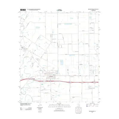
2013 Map of Brookshire
USGS Topo · Published 2013About this map
Brookshire serves as a primary hub of activity in this 2013 survey, situated where the interstate corridor meets the local rail infrastructure. The landscape is defined by its extensive network of drainage systems, including Bessies Cr and Bell Bottom Cr, which weave through a grid of rural roads and agricultural plots. The area's commitment to general aviation is remarkably prominent, with several specialized facilities such as Houston Executive Airport and Sport Flyers Airport dotting the plains. Genealogists and local historians can locate established burial grounds like the Brookshire Cem and Wilpitz Cem, while the small communities of Cardiff and Johnsue mark the eastward expansion toward the suburban edge. The map captures the transition from traditional farming tracts to modern transportation and aviation hubs.
Find a feature on this map
110 named features on this map. Tap any name to fly to it.
Don’t see what you’re looking for? This feature index may not catch every label — zoom into the map to look around manually.
Map Details
Editions of this 2013 Brookshire Map
This is the sole edition of this map. No revisions or reprints were ever made.
Other maps of this area

1915 · Katy
USGS Topo · 1:24,000

1916 · Swanson
USGS Topo · 1:24,000

1919 · Swanson
USGS Topo · 1:31,680

1950 · Houston
USGS Topo · 1:250,000

1953 · Seguin
USGS Topo · 1:250,000

1955 · Brookshire
USGS Topo · 1:62,500

1955 · Richmond
USGS Topo · 1:62,500

1956 · Sealy
USGS Topo · 1:62,500

1956 · Wallis
USGS Topo · 1:62,500

1956 · Houston
USGS Topo · 1:250,000